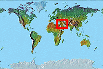
ANCIENT NEAR EAST SITE MAPS
This first installment of the Oriental Institute Map Series presents seven Site Maps covering the ancient Near East (Egypt, Sudan, The Levant, Syria, Turkey, Iraq, and Iran), locating primary archaeological sites, modern cities, and river courses set against a plain background. All Site Maps are Simple Conic projections at the same scale and orientation.
Future versions of the Oriental Institute Map Series will include terrain relief as a background for each of the seven Site Maps, one version colored for elevation and a second version colored for vegetation, as well as latitude and longitude (graticule) lines.
The Oriental Institute Map Series is a publication of the Oriental Institute Computer Laboratory, which welcomes your comments and suggestions regarding future versions of the Map Series. Email them to the John C. Sanders, Oriental Institute Computer Laboratory.
The Oriental Institute Map Series was produced from map projection, terrain relief, and cartographic data in the Mountain High Maps product, by Digital Wisdom, Inc., of Tappahannok, Virginia.

